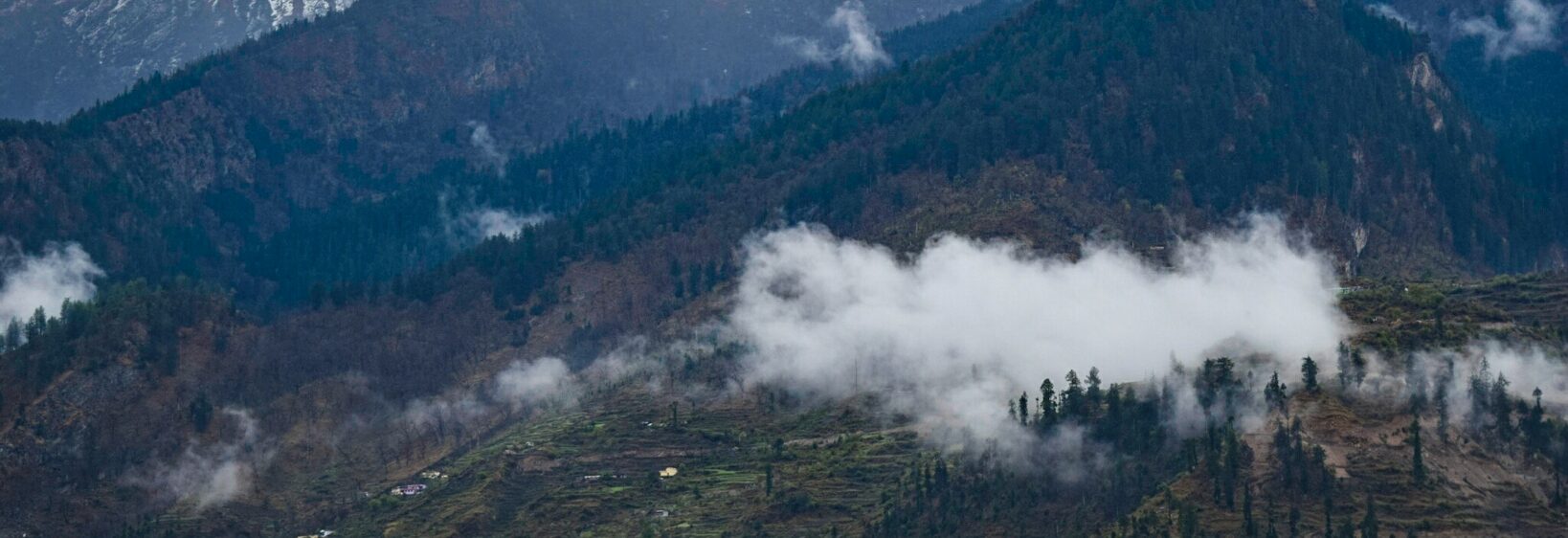
The Jolly Grant Airport Approach: Aerial Views of the Shivaliks
The descent into Jolly Grant Airport near Dehradun is one of northern India’s most memorable aviation approaches. From the aircraft window, the flat Doon Valley gradually gives way to forested foothills, winding rivers and the rising ridges of the Shivalik range.
For travellers flying from Australia, the view offers an immediate change of scale. A departure from Sydney, Melbourne or Perth may begin above a familiar coastal skyline, while the final approach in Uttarakhand reveals villages, terraced fields and Himalayan foothills arranged in a much quieter landscape.
The airport serves Dehradun, Rishikesh and a wide section of Garhwal. It is also a practical starting point for journeys towards Mussoorie, Haridwar, Rudraprayag, Joshimath and other mountain destinations. The flight itself becomes a visual preview of the roads and valleys ahead.
Photographs taken from the cabin can be striking, although reflections, haze and restricted photography around airports require care. A thoughtful travel guide such as Uttarakhand photo stories can help place those fleeting aerial scenes within their cultural and geographical setting.
Reading The Landscape From Above
Jolly Grant Airport lies in the Doon Valley, a broad basin bordered by the Shivalik hills to the south and the higher Himalayan ranges beyond. During the approach, the lower hills often appear as layered folds, with darker woodland covering their slopes and pale roads cutting across the terrain.
The Song River and other seasonal waterways may be visible as silver or sandy lines. Their appearance changes with the season: monsoon rain can widen channels and deepen the green of the valley, while the drier months create a more muted palette of brown fields, dusty tracks and blue-grey ridges.
The clearest views commonly occur during cooler months, especially after a spell of settled weather. Morning flights can provide softer light, while late afternoon approaches may cast long shadows across the hills. Cloud can hide the distant peaks, yet the nearer Shivaliks remain atmospheric and detailed.
Choosing A Window Seat
A window seat is the natural choice for passengers hoping to see the terrain. On an arrival into Dehradun, views may shift quickly between the valley floor, airport perimeter and surrounding foothills, so keeping a camera ready before the descent begins is useful.
Photography through aircraft glass works best when the lens is held close to the window without touching it. Turning off the flash prevents reflections, and a simple phone camera often handles the broad landscape better than a long telephoto lens. Avoid photographing security installations, military areas or airport operations.
Australian travellers may be accustomed to strict aviation and privacy expectations at airports in Brisbane or Melbourne. Similar awareness is sensible here. Cabin crew instructions take priority, and images should focus on the landscape rather than identifiable passengers, staff or restricted facilities.
Simple Ways To Prepare
Before landing, travellers can:
- Charge a phone or camera fully
- Clean the window-facing lens
- Keep a light jacket accessible
- Check the weather for Dehradun
After arrival, it helps to:
- Save offline maps before leaving the airport
- Carry small Indian rupee notes for local transport
- Use registered taxis or pre-arranged transfers
- Allow extra time for valley traffic
Seasonal Colours And Local Life
The aerial view changes dramatically through the year. In the monsoon, the Doon Valley is lush, with swollen streams and vivid paddy fields. Landslips and wet roads can affect onward journeys, so visitors should check local conditions before travelling towards hill stations.
Winter often brings crisp light and clearer horizons, though fog can affect the valley and delay flights. Spring brings fresh foliage and flowering trees, while summer produces brighter, drier colours before the rains arrive. These seasonal differences are valuable for photographers planning a broader Uttarakhand trip.
From above, the landscape may look untouched, but it is closely connected to everyday life. Small settlements, agricultural plots, temple complexes and roads occupy the spaces between forested slopes. The view reflects a working region rather than a wilderness reserved solely for tourism.
This contrast may feel familiar to visitors from Australia, where a flight over Melbourne’s outer suburbs or Perth’s expanding fringe can reveal the relationship between housing, farms, highways and bushland. In Uttarakhand, that pattern is compressed against steep hills and shaped by rivers, pilgrimage routes and seasonal weather.
From The Runway To The Hills
Jolly Grant Airport is more than an arrival point. It links the valley with pilgrimage centres such as Rishikesh and Haridwar, wellness retreats, rafting areas and the mountain roads leading towards Garhwal. A short transfer can take visitors from an organised airport environment to busy markets, riverside ghats or quiet forest roads.
Local transport varies in comfort and timing. App-based services may be limited outside major centres, while shared jeeps, taxis and buses remain important for regional travel. Bargaining is common in some local markets, but agreed fares and written booking details reduce confusion, especially when travelling with luggage or camera equipment.
Australian visitors should also consider practical rules before departure. India’s e-visa process should be checked through official government channels, and Australian biosecurity law requires travellers to declare food, plant material and animal products when returning home. Even a piece of fruit or a packet of seeds can create problems at the border.
Drone photography requires separate attention. India’s aviation regulations restrict where and how drones may be operated, particularly near airports, defence sites and crowded areas. An aerial photograph from a passenger window is very different from launching a drone, so permissions and current DGCA requirements should be confirmed before carrying equipment.
Planning A Responsible Photo Journey
The approach is best treated as the first frame in a wider visual journey. After landing, visitors can explore Dehradun’s markets, continue to Rishikesh, or follow the mountain road towards Mussoorie and beyond. Each route reveals a different relationship between the Shivaliks and Himalayan foothills.
Local markets are especially rewarding for photographs of colour and texture: woollens, brass items, spices, fruit, religious objects and hand-painted signs. Ask before photographing people, market stalls or ceremonies. A friendly greeting and a small purchase often create a more respectful exchange than taking a quick, uninvited image.
| Viewpoint or moment | What it may reveal | Best approach |
|---|---|---|
| Aircraft window during descent | Layered hills and valley patterns | Use a clean lens and avoid flash |
| Airport transfer road | Settlements, fields and foothill vegetation | Photograph only from safe stopping points |
| Dehradun or Rishikesh market | Local colour, crafts and daily life | Ask permission for portraits |
| Monsoon journey | Green slopes and active waterways | Check road and weather conditions |
The most rewarding images combine the dramatic aerial perspective with details found on the ground. A river seen from the cabin becomes more meaningful after walking beside it; a patchwork of fields gains context through conversations, food and the rhythm of local travel. That connection makes the airport approach a genuine beginning to an Uttarakhand experience.