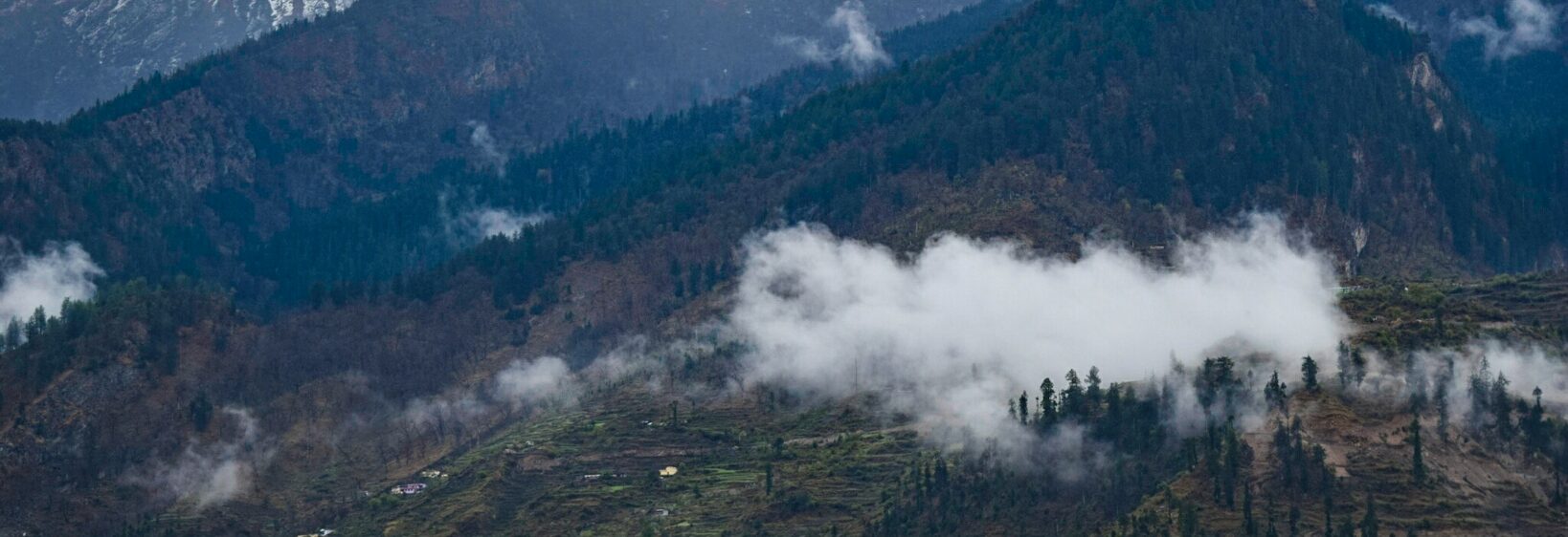
Khirsu village: orchards, quiet trails and Himalayan views
Khirsu is a peaceful hill village in Uttarakhand’s Pauri Garhwal district, set at roughly 1,700 metres above sea level. Its appeal lies in the calm rhythm of mountain life: terraced fields, fruit trees, stone homes and broad views towards the snow-covered Himalayas.
Unlike busier destinations such as Mussoorie or Rishikesh, Khirsu has a slower, more local character. Apple, pear and plum orchards surround the settlement, while oak and deodar forests add shade to the walking routes. On a clear morning, distant peaks appear above the green ridges.
For Australian travellers, the village suits a quiet extension to a northern India itinerary. Visitors from Sydney, Melbourne or Brisbane can combine Khirsu with Rishikesh, Haridwar, Devprayag, Srinagar or Pauri, allowing time for mountain scenery without the crowds of better-known resorts.
Where Khirsu sits in Uttarakhand
Khirsu lies around 15 kilometres from Pauri, with winding roads climbing through forested slopes and scattered villages. The journey is part of the experience: roadside tea stalls, terraced farms and occasional viewpoints reveal how closely daily life is connected to the land.
Travellers commonly reach the area from Rishikesh or Haridwar by road, passing through Devprayag and Srinagar before continuing towards Pauri. Kotdwar provides another approach, while Jolly Grant Airport near Dehradun is the nearest practical airport for many visitors. Mountain roads can be slow, so a short distance on a map may require several hours.
The best months for clear mountain views are generally March to June and September to November. Monsoon rain can bring slippery roads and cloud, while winter mornings are cold and occasional frost adds a crisp edge to the landscape.
Orchards and village life
The orchards are central to Khirsu’s identity. In spring, fruit trees bring pale blossoms to the hills; later in the year, apples, pears and plums develop among the leaves. Harvesting remains closely tied to household routines, with produce used locally or sold through small roadside and regional markets.
A walk through the village offers a glimpse of Garhwali life rather than a staged tourist display. Women may be working in fields, families may gather around wood-fired kitchens, and children often travel between hamlets along narrow paths. Ask permission before photographing people, homes or religious activities.
Visitors from Australia may be used to organised weekend farmers markets in Melbourne or Sydney, where produce is labelled and packaged. In Khirsu, buying fruit or local goods is more personal: carry small Indian rupee notes, check availability by season and treat the exchange as a conversation rather than a quick transaction.
Walks, temples and mountain air
Short walks around Khirsu lead through pine and oak woodland, orchards and quiet ridgelines. The terrain is generally gentler than a high-altitude trek, although uneven paths, loose stones and steep edges still require proper footwear. A local guide can explain plant names, village customs and routes that are difficult to identify from online maps.
The nearby Ghandiyal Devta Temple reflects the spiritual traditions of the Garhwal region. Simple shrines and village temples often serve as community spaces, so modest clothing and quiet behaviour are appropriate. Shoes should be removed where requested, and photography may be restricted during rituals.
Those wanting a more demanding Himalayan outing can compare the experience with this Khaliya Top sunset hike, which offers a higher and more exposed mountain environment near Munsiyari. Khirsu is better suited to gentle exploration, orchard walks and unhurried viewpoints.
Practical details for Australian visitors
Pack layers rather than relying on one heavy jacket. Even sunny afternoons can feel mild at altitude, while nights become cold. Australians accustomed to sun protection in cities such as Perth or Brisbane should continue using a hat, sunscreen and sunglasses; highland sunlight can be intense even when the air feels cool.
Mobile coverage can be inconsistent, and power cuts are possible. Download offline maps, keep a small torch available and carry drinking water during walks. Tap-and-go habits common in Australia are less dependable in remote Uttarakhand, so cash is useful for transport, snacks and small homestays.
Australian school holidays can make flights and popular Indian destinations busier, especially around December and January. Check Indian visa requirements before departure, and remember Australia’s biosecurity legislation: fresh fruit, seeds, soil and plant material should not be packed for the return journey. Local Indian rules may also restrict drones near temples, roads or sensitive sites.
Choosing a stay and planning a visit
Accommodation in and around Khirsu is usually made up of guesthouses, government tourism properties and small homestays rather than large resorts. A homestay can provide regional meals such as dal, rice, seasonal vegetables and local breads, while a larger property may offer more predictable heating and transport assistance.
Reserve ahead during spring, autumn and Indian public holidays, particularly if you need an en-suite room or private vehicle. Ask whether hot water, meals, parking and heating are included. Responsible visitors should avoid wasting water, keep noise low and take plastic waste back to a proper disposal point.
Wildlife encounters are less theatrical here than in a dedicated sanctuary, yet the forests support birds, butterflies and small mammals. Travellers interested in winter animal viewing may enjoy this snow monkey guide, while Khirsu offers a quieter focus on landscapes, village culture and Himalayan light.
| Travel aspect | Useful expectation |
|---|---|
| Best seasons | March to June and September to November |
| Main landscape | Orchards, forests, terraces and distant snow peaks |
| Access | Road journey from Rishikesh, Haridwar, Srinagar or Kotdwar |
| Accommodation | Homestays, guesthouses and tourism properties |
| What to carry | Cash, layers, walking shoes, water and offline maps |