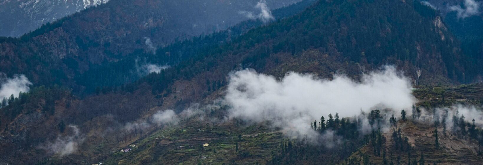
Gangotri glacier trek: ice formations and Gaumukh snout
The Gangotri Glacier Trek leads from the temple town of Gangotri to Gaumukh, where a broad glacier ends above the upper Bhagirathi valley. It combines a moderate Himalayan walk with close views of crevasses, seracs, meltwater channels and shifting moraine.
The route is usually walked over four to six days, with the highest ground near 3,900–4,000 metres. Ice is never static here: seasonal snow, avalanches and meltwater continually redraw the surface seen by trekkers and photographers.
Australians commonly reach the trailhead from Delhi after arriving from Sydney, Melbourne or Brisbane. Season matters, especially because Australian winter runs from June to August while the clearest Himalayan walking weather often falls between late May and June, or after the monsoon breaks in September.
The experience rewards slower observation. Rather than treating the glacier as a single white landmark, visitors can read its separate features—ice towers, debris bands, frozen streams and the moving edge of the Gaumukh snout.
Walking from Gangotri to the moraine
Start in Gangotri at roughly 3,100 metres and follow the valley east. The trail passes Akhri Ganga and Bhojbasa before climbing through forest, meadow, scree and alpine scrub toward Tapovan and the glacier’s terminal moraine.
Small settlements and roadside teahouses shape the journey, while prayer flags and the evening Ganga aarti at Gangotri add a devotional dimension. Australian walkers accustomed to marked bush tracks should still expect narrow paths, livestock, unstable edges and rapidly changing weather.
Reading the glacier’s ice formations
Seracs rise where heavily fractured ice stands above the surrounding surface. Nearby, dark crevasse lines cut through blue-white walls, and debris-covered ridges reveal how dirt, rock and shattered ice travel within the moving glacier.
Surface streams carve temporary channels between ice towers before draining through moulins. The contrast between clean snow, dirty ablation ice and exposed moraine makes these changing features easier to distinguish in photographs.
Facing the Gaumukh snout
Gaumukh marks the upper end of the trek, with views towards the glacier’s snout at around 3,900–4,000 metres. The exact accessible viewpoint can shift as ice and moraine move, so guides follow current conditions rather than a fixed photograph position.
The name means “cow’s mouth”, traditionally associated with the shape of the glacier’s lower edge. Meltwater from this system feeds the Bhagirathi, which later joins the Alaknanda at Devprayag to form the Ganga. The view therefore connects directly with the religious and geographical importance of Gangotri.
Choosing the season and managing altitude
Late spring and early autumn generally offer the clearest trails, while monsoon rain can produce landslides and swollen streams. Winter brings deep snow and cold nights. For Australians, this seasonal contrast is useful: a July escape from Sydney or Melbourne can coincide with excellent Himalayan snow at higher elevations.
Headaches, nausea or unusual fatigue can indicate altitude illness. Spending an extra night at Gangotri or Bhojbasa helps many walkers acclimatise, while an experienced local guide can identify changing snow, rockfall and moraine hazards that maps may not reveal.
Planning gear and trail routines
Australian outdoor retailers in Sydney and Melbourne stock lightweight merino layers familiar to local walkers, while an insulated jacket and waterproof shell become essential higher up. The region’s handcrafted clothing traditions are illustrated in this feature on Uttarakhand woollen shawls.
Carry a refillable bottle and purification tablets because stream water needs treatment. Compact dried fruit, nuts and energy bars are practical between village shops, where menus may be simple but plentiful. A camera bag should remain accessible without blocking the shell.
Before departure, use a familiar Australian bushwalking routine:
- Broken-in boots, Merino base layers and a fleece
- Waterproof shell, gloves, warm hat and sun protection
- Trekking poles, headlamp and spare batteries
- Water treatment, high-energy snacks and a small first-aid kit
On the Himalayan trail, adjust that routine for altitude:
- Check current entry requirements and local instructions
- Carry identification, insurance details and emergency contacts
- Keep away from crevasse edges and unstable moraine
- Follow guides regarding restricted glacier access
Building a budget from Australia
Price the trip in Australian dollars before comparing quotes in rupees. A general-purpose trip budget counter can separate transport, guiding, lodging, meals and equipment costs, helping travellers identify quotes that omit essential inclusions.
The familiar ritual of collecting a takeaway coffee from a Melbourne laneway before an early departure has a loose Himalayan equivalent: an early tea beside the Gangotri temple. Local guesthouses, simple lodges and camp meals can suit different budgets, but the final route should allow weather delays.
Using a registered local operator can reduce logistical pressure around permits, transport and trail conditions. Australian travellers should also note that emergency number 000 does not operate in India; save the relevant Indian contacts before leaving home and avoid relying on Australian mobile coverage.
Photographing a landscape in motion
A wide-angle lens captures the scale between the moraine and glacier, while a longer focal length isolates seracs and crevasse patterns. Exposure often changes quickly as cloud shadows cross the ice, so checking histogram settings protects detail in both snow and dark rock.
Broader image collections and destination stories from UK Photos Gallery provide useful context for the temples, villages and mountain landscapes surrounding this route. Morning sidelight can reveal ridges and blue ice, whereas late afternoon colour gives warmer tones to the upper peaks.
Photographs work best when they record relationships: people against scale, meltwater beside ice, or prayer flags framed by an unstable moraine. At Gaumukh, the fractured face of the glacier continues to shift above a valley shaped by water and stone.