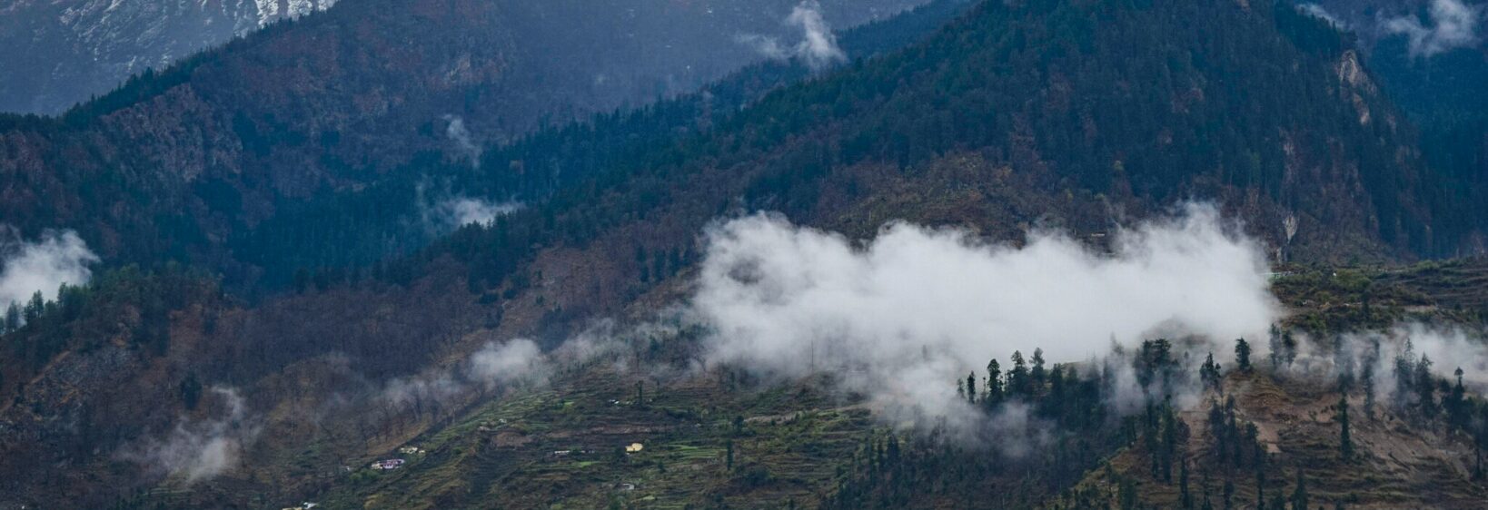
Tapovan to Bamini Bugyal: wild camping and alpine pastures
Tapovan is where the Dhauliganga and Garud Ganga rivers meet, a green staging point below the high meadows of Joshimath. From here, the path rises through a dramatic gorge into birch country, then opens onto Bugyal pastures where herders still graze their flocks.
The Tapovan to Bamini Bugyal route covers roughly 18–20 kilometres, usually walked over four days. Wild camps, clear mountain air and expansive grassland are the rewards, but sensible preparation is essential. Camping is possible along the trail, while village guesthouses offer a warmer alternative.
Where the trail begins
At about 2,300 metres, Tapovan sits far lower than Bamini, which reaches approximately 3,800 metres. The first stretch follows the Dhauliganga, crosses a suspension bridge and enters a narrow, rock-cut corridor. Water drops, forested slopes and distant snow peaks create a dramatic Himalayan approach to the Bugyals.
After the gorge, the trail climbs through Ren and across Khullara Bugyal, with side valleys offering views towards the Dhauliganga and Dhaula Dhar peaks. For a broader visual introduction, the Joshimath photographs on UK Photos Gallery help travellers picture the landscapes they will encounter.
Choosing the season and preparation
April to June and September to early October generally offer the most dependable trail conditions. The monsoon can wash out paths and trigger landslides, while winter snow may close the higher sections. Even during the better seasons, afternoon clouds, rain or hail are possible, so a waterproof shelter remains useful.
Check current forest and district notices before departure, as camping and access rules can change. Foreign visitors should carry their passport, and every trekker needs an emergency contact, offline maps and a flexible plan for transport disruption between Joshimath and the roadhead.
Australian bushwalkers will recognise the priorities: offline navigation, spare layers and careful food storage. Their custom of leaving no trace, familiar from Sydney’s Royal National Park, matters around these sensitive meadows. Oats and freeze-dried dinners are familiar Australian camp foods, while Tapovan’s small provision shops sell similar staples. Distances use kilometres and temperatures Celsius, so no conversion is needed. Visitors from Melbourne or Sydney should allow an overnight stop in Delhi before Joshimath, rather than rushing a flight, bus and mountain transfer into one day.
Walking the route in stages
Day one is usually Tapovan to Ghandhi Sarovar, around five kilometres and two to three walking hours. The gorge demands attention, but the final open valley feels spacious. Stay in a basic guesthouse or camp at an approved site if you prefer an early dinner and a warmer night.
From Ghandhi Sarovar, a shorter stage leads to Khullara Bugyal, the first broad pasture. A four-kilometre climb then reaches Bamini Bugyal, where wildflower meadows, rocky slopes and grazing animals replace the dense forest. Choose firm ground and shelter from the wind; avoid pitching tents on flower-rich patches.
A fourth day can take walkers towards Bhyundar and the high point of Tali Top before the descent to the roadhead. This extension adds time for acclimatisation and photographs rather than strenuous distance. If bad weather arrives, an earlier return preserves safety and avoids turning a gentle alpine trek into a difficult retreat.
Camping above the tree line
Pack a dependable tent, a sleeping bag rated for freezing nights, an insulated mat and a headlamp. Camps at 3,700–3,800 metres can feel bitterly cold after sunset, even when daytime sunshine makes a sweater seem excessive. Windproof layers, warm socks and dry spare clothing are more useful than heavy cotton.
Never assume stream water is safe. Filter or chemically treat it, carry enough for the first camp and ask campground owners about nearby sources. Respect local fire restrictions, keep food sealed against wildlife and carry rubbish back with you. Human waste also needs a responsible disposal plan where toilets are absent.
Photography benefits from patience around dawn and dusk. The landscape photography portfolio offers a useful reference for changing light on this kind of route, but a warm, waterproof camera kit matters more than a tripod.
Village life and pastoral seasons
Ren and the surrounding valleys are home to Gurung communities and seasonal Dhangar herders, with Hindi and regional languages used alongside English in basic guesthouses. Sheep and goats may cross the trail without warning, while working dogs guard camps rather than welcome strangers. Walk slowly, share the path and ask before photographing people, homes or animals.
Simple mountain meals are the norm: dal, rice, potatoes, flatbreads and hot tea from small dhabas. Vegetarian food is easy to find, but meat availability varies. Keep snacks for the trail and carry water between settlements, since few reliable shops appear beyond Tapovan and the scattered villages.
Alpine meadows are working landscapes, not empty scenery. Keep to durable ground, avoid blocking animals and follow any rotational grazing instructions. This restraint protects the grasslands that make this high-altitude trek memorable while allowing herders to continue their seasonal routines.
Choosing your level of comfort
Supported treks usually include porters, meals and village guesthouses, leaving more energy for the meadows and less time for pitching a tent. Independent walking offers greater flexibility and solitude, although permits, weather delays and transport must be handled personally.
Wild camps put you closer to stars, silence and sunrise, but comfort depends entirely on your equipment. Lodge nights are sensible for travellers prone to altitude problems or seeking warmer sleep. Choosing the right balance matters more than covering every photograph or summit viewpoint.
| Approach | Overnight arrangement | Best for | Trade-off |
|---|---|---|---|
| Supported trek | Guesthouses, meals and porters | Recovery and help during delays | Less time alone |
| Self-guided trek | Village stays with your own tent | Flexible pacing and lower costs | Permits and logistics are yours |
| Wilderness-style camping | Approved pitches with all gear carried | Quiet nights and sunrise light | Cold, weight and weather exposure |
Leave time for the route rather than the itinerary. Slow mornings reveal grazing herds, distant storms and shifting light, while an unhurried descent gives the body time to adjust. For many walkers, those quiet hours in the Bugyals are the true attraction.