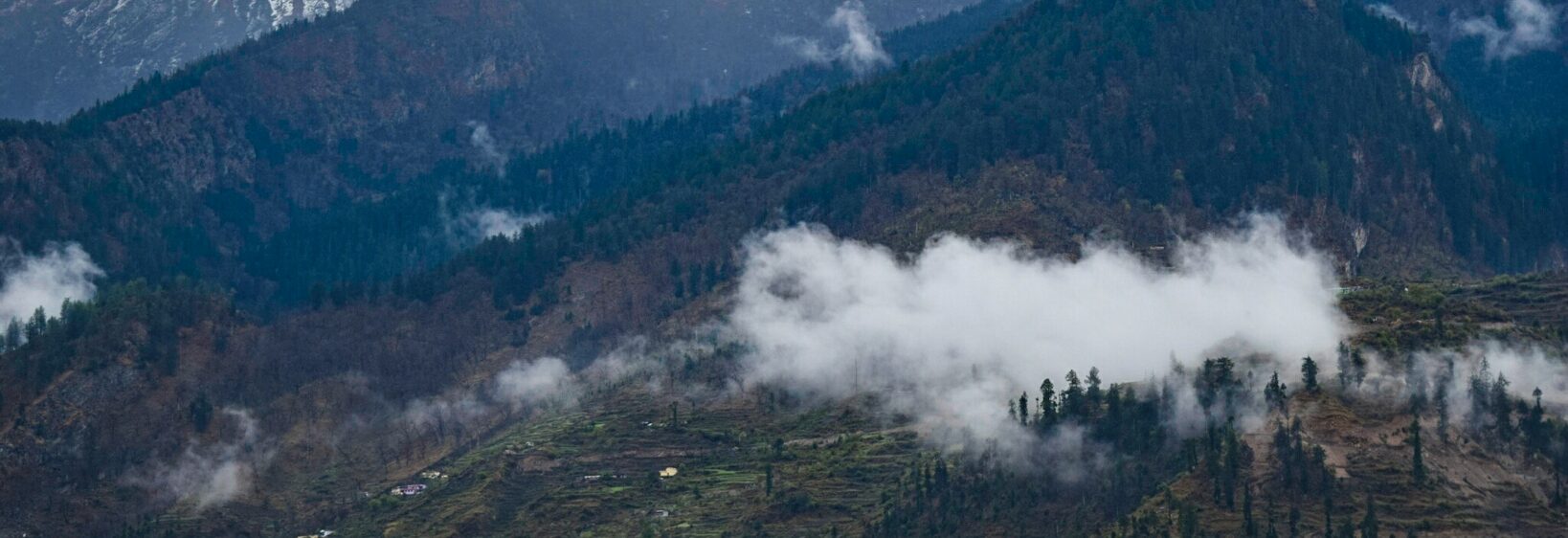
Chopta Valley in autumn frames gold leaf and Himalayan silence
When the monsoons retreat and the first cold snaps arrive in October, Chopta Valley becomes one of Uttarakhand's most photogenic surprises. The meadows stiffen with frost at dawn, birch groves flush yellow, and the snowline on peaks like Chaukhamba drops visibly from one day to the next. Travellers used to autumn in Tasmania or the Blue Mountains will find the colour familiar but the scale entirely different — the horizon here is built from 6,000-metre rock, not sandstone cliff.
This stretch of Garhwal has long drawn pilgrims bound for Tungnath and trekkers chasing Chandrashila, yet few plan a trip specifically for autumn colour. Photographers arriving from Melbourne, Sydney and Perth are now treating Chopta as a soft-adventure counterpoint to the well-worn Himachal and Ladakh routes.
What follows is a route for anyone weighing the trip — the realities of a fifteen-hour hop west, the markets you pass through, and the frames worth chasing once the light turns amber.
How autumn reshapes the valley
Chopta sits at 2,900 metres, hemmed in by oak, birch and rhododendron forest. Through October, leaves rust and ochre, silver birches shed a slow cascade of yellow, and alpine grass flattens into a tawny mat. Day-night swings are sharp — a tee by mid-morning, four layers by sundown — which throws long shadows across the Deoria Tal approach road.
For someone used to the Huon Pine forests of western Tasmania in May, the palette reads like a cousin rather than a twin. Australian eucalypt gives a sage-and-silver stage; Chopta offers butter-yellow underbellies against a pewter sky. Both reward a telephoto and patience, and very little filter.
Reaching Chopta and where to sleep
The usual route runs from Delhi or Dehradun to Ukhimath or Sari village, then a winding climb of roughly five hours to the meadow. Australians on a working-holiday-style schedule find the cheapest option is an overnight bus from Rishikesh, though most visitors now hire a shared cab or rent a 4x4 out of Haridwar.
Accommodation is honest more than plush. The GMVN Tourist Rest House at Chopta books out months ahead; if you miss out, try tents and lodges down at Baniyakund, or the small cluster of guesthouses at Dugalbitta. Campers will recognise the same casual BYO-everything feel of a backcountry site near Walhalla — pitch the tent, store food in the bear-proof lockers, respect the no-fire rule above the treeline.
What the yellow bloom really is
The autumn "yellow bloom" the valley is famous for is not a flower but the deciduous canopies of birch and Himalayan maple, which hold colour into late November before the first heavy snow folds them down. Against them, Buransh (Rhododendron arboreum) plants push crimson blossom buds that refuse to open until the following spring — a quiet trick locals have used for centuries as a natural calendar.
Wander about a kilometre off the road toward the meadows south of the campsite and you find the densest stands. Fog settles here on still days and turns the grass to a silver sea; by ten o'clock it lifts and the gold arrives.
Light, lenses and the panoramic frames
Chopta's signature frame is the ridge that swings west from the Tungnath path, where the birch canopy dips into a saddle and reopens onto a sudden, full-arc view of the Garhwal giants. Photographers usually set up ninety minutes before sunrise, when the eastern peaks pick up a thin alpenglow and the valley below is still indigo. A 24–70mm handles most of the work, with a 70–200mm for compressing the ridgelines.
For pack-down logic, a small-frame camera guide suits travellers keeping carry-on under seven kilos on Jet Airways flights. Two other dependable frames are the Deoria Tal ridge at golden hour and the upper meadows north of the bus stand, where a single dead birch anchors the foreground against Trishul's ice wall.
Side trips and longer circuits
Most travellers use Chopta as a base for one of four classic routes. Tungnath climbs 3.5 km to the world's highest Shiva temple; Chandrashila adds another steep kilometre to a 4,000-metre summit with 360-degree views. Deoria Tal sits lower and rewards sunrise reflections rather than altitude. The remote outlier is the https://ukphotosgallery.com/blog/56657-the-madhyamaheshwar-temple-trek-remote-himalayan-shrine — a multi-day circuit ending at a stone shrine few outsiders reach each season.
| Trail | Distance from Chopta | Effort | Standout frame |
|---|---|---|---|
| Tungnath | 3.5 km one way | Easy | Stone temple at cloud level |
| Chandrashila | 5 km round trip | Moderate | 360° summit panorama |
| Deoria Tal | 28 km drive south | Very easy | Reflected peak at sunrise |
| Madhyamaheshwar | 22 km to trailhead | Strenuous | Remote shrine circuit |
Practicalities for the long-haul flight
Australians should plan for at least three internal connections beyond Delhi. The e-visa runs roughly AUD 40, and most banks change Australian dollars at Delhi or Dehradun counters without commission. Vodafone or Airtel SIMs are easy to grab at the airport after biometric registration — useful before you head north, since 4G thins out above 2,500 metres.
Altitude becomes a real consideration once you cross Tungnath at 3,680 metres. Drink more water than you think you need, skip the whisky ration locals will offer, and budget two acclimatisation days in Rishikesh. Australian chemists stock acetazolamide as Diamox, but bring a script or buy a short course in Delhi before the climb.
Photo stops to build a route around
- The birch grove south of the GMVN rest house, best between 7:30 and 9:00 am
- The Chandrashila saddle, sunrise catching Nanda Devi's eastern wall
- The Deoria Tal ridge at first light, lake mirroring Chaukhamba
- The road cutoff near Dugalbitta, oak and maple mid-afternoon
What to pack for a four-day autumn shoot
- A mid-weight down jacket that packs into its own pocket
- Layered merino tops rather than cotton, which freezes at altitude
- Broken-in waterproof boots with serious ankle support
- A wide-angle lens cap and microfibre cloth for fog-prone mornings