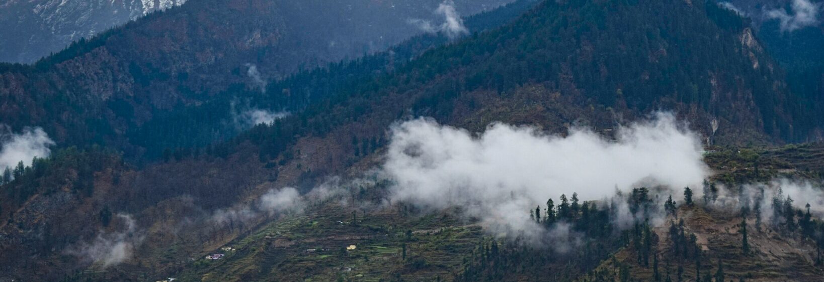
Madari Hat in Mukteshwar: Pine Forests and Sunset Points
Madari Hat rises above Mukteshwar in Uttarakhand, where a quiet road threads through deodar and chir pine before opening onto a ridge at roughly 2,550 metres. Madari Hat in Mukteshwar offers a compact Himalayan escape: travellers can spend the afternoon walking through cool woodland, then reach a sunset viewpoint without a long trek.
On clear evenings, the distant skyline can include Trishul, Nanda Devi and Chaukhamba. Closer details matter too: pine-scented paths, birdsong, roadside dogs and the gradual change from shaded forest to open sky make the approach as memorable as the view.
The route suits photographers, families and walkers wanting a manageable outing. It rewards timing rather than speed, particularly when colour shifts across the peaks after the sun drops below the ridge.
Reaching the ridge from Mukteshwar
A winding road climbs from the Barkot side towards the Madari Hat area. It is not a remote mountain hike, but steep bends, narrow sections and roadside stopping places can make the final kilometres slower than expected. Check local weather and ask your Mukteshwar accommodation about access.
For broader planning, Near the Lighthouse offers another source of regional travel information. Allow time to reach the trailhead, walk to the viewpoint and settle before the evening crowd builds.
Walking through the pine forest
The short approach passes through chir pine, with deodar and broadleaf trees lower down. The forest is dimmer and quieter than the open Himalaya beyond, making the final viewpoint feel surprisingly peaceful.
Other Himalayan routes reward different interests. The Birthi Falls guide follows a wooded route near Munsiyari, where the focus shifts from sunset panoramas to a waterfall and the walk down to it.
Sunset over the high Himalaya
The attraction is the long western view. When the atmosphere is clear, summits such as Trishul, Nanda Devi and Chaukhamba appear beyond nearer ridges. The best photographs often come during the final colour change, rather than at the brightest moment.
Arrive about an hour before sunset to find a position, then resist leaving immediately. The sky can deepen from gold to pink and violet, and low cloud can settle into valleys while peaks remain visible. A small tripod and zoom lens are more useful than a heavy camera bag.
Comparing other Himalayan walking escapes
Madari Hat suits visitors wanting a forest-to-viewpoint walk with limited walking. Around Nainital, the Pangot birdwatching walk explores village lanes, oak woodland and quieter uplands, making it useful for travellers seeking birds and local life rather than a large summit panorama.
The destinations are complementary rather than interchangeable. Birthi Falls pairs dense greenery with rushing water near Munsiyari; Madari Hat combines similar woodland with a high, open horizon. Choosing one route per day gives walkers time to photograph surroundings rather than rush between viewpoints.
Planning for Australian travellers
Travellers from Sydney or Melbourne are used to planning weekend escapes, but Himalayan road conditions demand flexibility. Allow extra time for repairs, livestock or a landslide, and check whether heavy rain has affected access. Like an Australian alpine walk in winter, this trip needs warm layers even when the valley feels mild.
Australia drives on the left, and most rental cars there have the steering wheel on the right, so Indian road habits require attention. At Madari Hat, stop only where it is safe, watch for oncoming traffic around blind bends and avoid walking along the carriageway.
Supermarkets such as Coles and Woolworths make it easy to assemble snacks at home, while Australian dollars are the familiar travel currency. Carry cash for small stalls or drivers in remote areas, and keep a backup payment method. Connectivity can be inconsistent once the forest begins.
Weather, access and sensible expectations
October and the clearer days of late September often balance visibility with manageable temperatures. Monsoon rain can interrupt the road, and winter evenings become sharply cold after sunset. Check local conditions rather than trusting a clear morning in Delhi.
Respect posted rules from forest and site authorities: do not light fires, collect plants or leave plastic behind. NSW’s National Parks and Wildlife Act 1974 protects native life in Australian reserves, but the relevant legislation here comes from local authorities. Carry rubbish back down and keep to established paths.
| Destination | Landscape | Access and footing | Best appeal |
|---|---|---|---|
| Madari Hat, Uttarakhand | Chir-pine forest and an exposed ridge | Winding road and a short walking approach | Sunset views across the Himalaya |
| Dandenong Ranges, Victoria | Mountain ash, tree ferns and sheltered paths | Paved and marked walking tracks | Cool forest walks in warmer months |
| Royal National Park, NSW | Eucalypt woodland, sandstone cliffs and coastal heath | Marked trails with some unsealed sections | Bush walking close to Sydney |
| Grampians, Victoria | Open heathland and rocky summits | Sealed roads to many trailheads | Wide skies and longer ridge walks |
A practical checklist for Madari Hat
The path is short, but the evening changes quickly. Keep photographs balanced with time to watch the ridgeline, and leave the viewpoint before darkness makes the road difficult to judge.
A few preparations make the visit easier:
- Confirm the road and trailhead status with a local source on the day, especially after monsoon rain.
- Start the walk about 60–90 minutes before sunset, adjusting for the season and your own pace.
- Wear sturdy shoes and carry a warm layer, waterproof shell, water, head torch and charged phone.
- Check cloud and visibility before leaving; distant peaks may remain hidden for hours.
- Stay on established paths, follow local instructions and leave plants, fires and litter behind.
- Arrange a registered taxi or local guide for evening return journeys, and keep Australian dollars in cash as a backup.