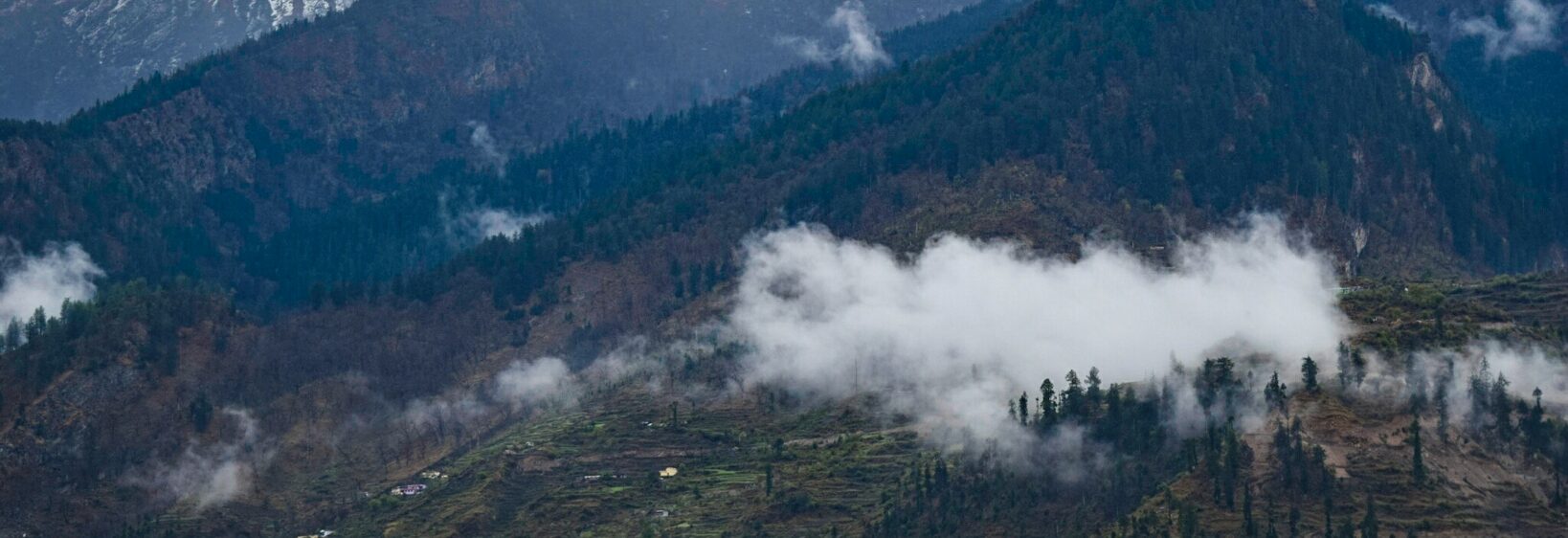
The Valley of Flowers in autumn: fading blooms and harsh terrain
Most visitors encounter the Valley of Flowers in its famous monsoon aftermath, when trails are damp and wildflowers mass across the slopes. An autumn journey reveals a quieter landscape: fewer petals, colder mornings, and mountain weather capable of ending a walk at any hour.
Access normally begins at Ghangaria, reached by a winding road from Joshimath. From there, the route climbs into a park lying roughly between 3,050 and 3,650 metres, with steep continuations towards Hemkund Sahib. Delays are common, so the park should never be treated as a quick stop between Rishikesh and another Himalayan destination.
Autumn has its own appeal, particularly for photographers and walkers seeking solitude. It also demands more caution than the familiar spring-to-early-autumn travel calendar suggests. A flexible itinerary, proper altitude preparation, and local help matter more here than simply chasing the last bright flowers.
The short autumn window
By late September, the valley’s famous carpets have usually thinned to patches of purple, yellow and white. The exact flowering date changes with altitude, rainfall and the preceding monsoon, so a photograph from one season can be misleading.
The park normally stays open until October, but the first substantial snow may close the road, conceal the path or trigger an early shutdown. Check current Uttarakhand notices rather than trusting a fixed “autumn end date” and travel blogs.
Flowers at their final stage
The Himalayan blue poppy, often called Brahma Kamal, is generally past its prime by this point, although isolated plants may linger. Late asters, gentians and grasses can still soften the scene, while seed heads and wet leaves provide texture when petals disappear.
Autumn colour is restrained, so work with small accents rather than expecting broad meadows of blue. For another Himalayan photography route with different seasonal rhythms and terrain, the Pithoragarh photography guide is a useful companion.
When weather reshapes the trail
September rain and October snow can turn the approach into a mix of mud, loose stone, icy steps and exposed scree. Strong winds may restrict views from the ridgelines, and a landslide can make the route to Hemkund inaccessible. Never assume the Lakshman Ganga bridge remains open simply because it appeared in an earlier photograph.
Hemkund Sahib sits at about 4,700 metres, where thin air, cold and physical exertion magnify every mistake. Headache, dizziness, nausea or unusual breathlessness are warning signs to stop ascent and seek medical help; continuing towards a sacred destination is not worth the risk.
Planning an itinerary from Australia
Many visitors from Sydney, Melbourne or Brisbane fly into Delhi or Dehradun, then continue by rail or road towards Joshimath. Australian travellers are accustomed to filling tanks before remote drives and carrying refillable bottles, yet monsoon debris and altitude make both habits more critical. Coles, Woolworths and weekend farmers’ markets make instant noodles, nuts and dried fruit easy to find at home, but all trail food must withstand repeated packing.
Driving is usually left to a local operator. An Australian licence alone is not sufficient for driving in India; carry an International Driving Permit with the original licence. As in Australia, mobile phones cannot be held while driving, and speed limits may change sharply near bends and settlements.
Photographing colour under fading light
Late light is more directional than in summer, creating warm rims on seed heads and cool blue shadows between slopes. A telephoto lens can compress layered ridges, while a circular polariser helps control glare on damp leaves without changing the subdued palette.
For visual sequencing and location scouting beyond the main trail, Mike off the Map offers a useful off-map perspective. Photograph without picking flowers, moving stones or crossing barriers just to improve a composition.
Australia’s Civil Aviation Safety Authority rules require many drones to be registered and operated at least 30 metres from people. That does not replace Indian state, park or local permission, so leave drones packed unless both systems of approval clearly apply.
Choosing a sensible base
Joshimath is the practical overnight base, while Ghangaria puts walkers close to the trail and reduces the chance of being caught by darkness or a late road closure. Stay at least one extra night locally if the forecast is uncertain.
For a gentler recovery night before or after the mountains, this selection of Ganges riverside campsites gives Rishikesh visitors a different riverside perspective. Camping there can ease travel fatigue, but it should complement rather than replace a properly booked mountain stay.
Field decisions that reduce risk
Park entry, vehicle access, registration requirements and guide services can change between seasons. Confirm them directly with official Uttarakhand and local authorities, and ask the accommodation provider what route status they last observed. Local operators are especially valuable when heavy rain has washed out a stretch of trail.
Many Australian travel policies exclude trekking above 3,000 metres unless the activity and altitude are declared. Read the policy wording before purchase, not only the headline price, and carry a spare medication supply in case delay forces an overnight stay.
- Confirm current park dates, road conditions and permit requirements before making non-refundable bookings.
- Use Ghangaria as the walking base and allow a spare weather day rather than following a rigid same-day schedule.
- Hire a licensed local guide or porter for exposed routes and disclose relevant medical conditions.
- Carry waterproof layers, microspikes, trekking poles, essential medicines and high-energy food.
- Turn back if ice, landslide, lightning or worsening altitude symptoms make the path unsafe.
- Declare the trekking altitude to your Australian insurer and follow park rules for drones, waste and flower protection.